Stories
Our curriculum currently runs for two whole school years. These are just some of the highlights we have during a normal Arribada Club programme, for both our Year One and Year Two students.
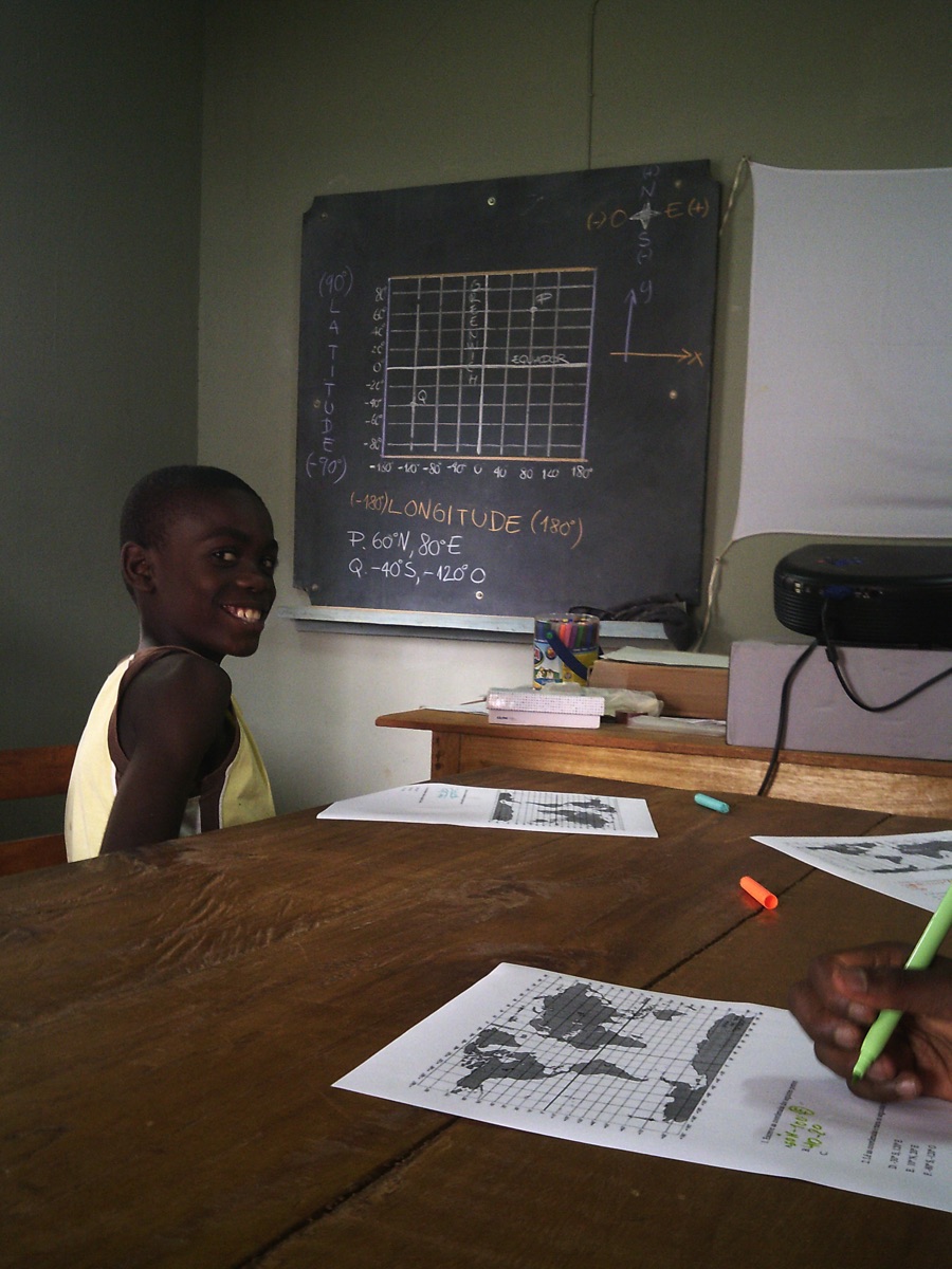
FEBRUARY | Rockets, GPS and Trilateration
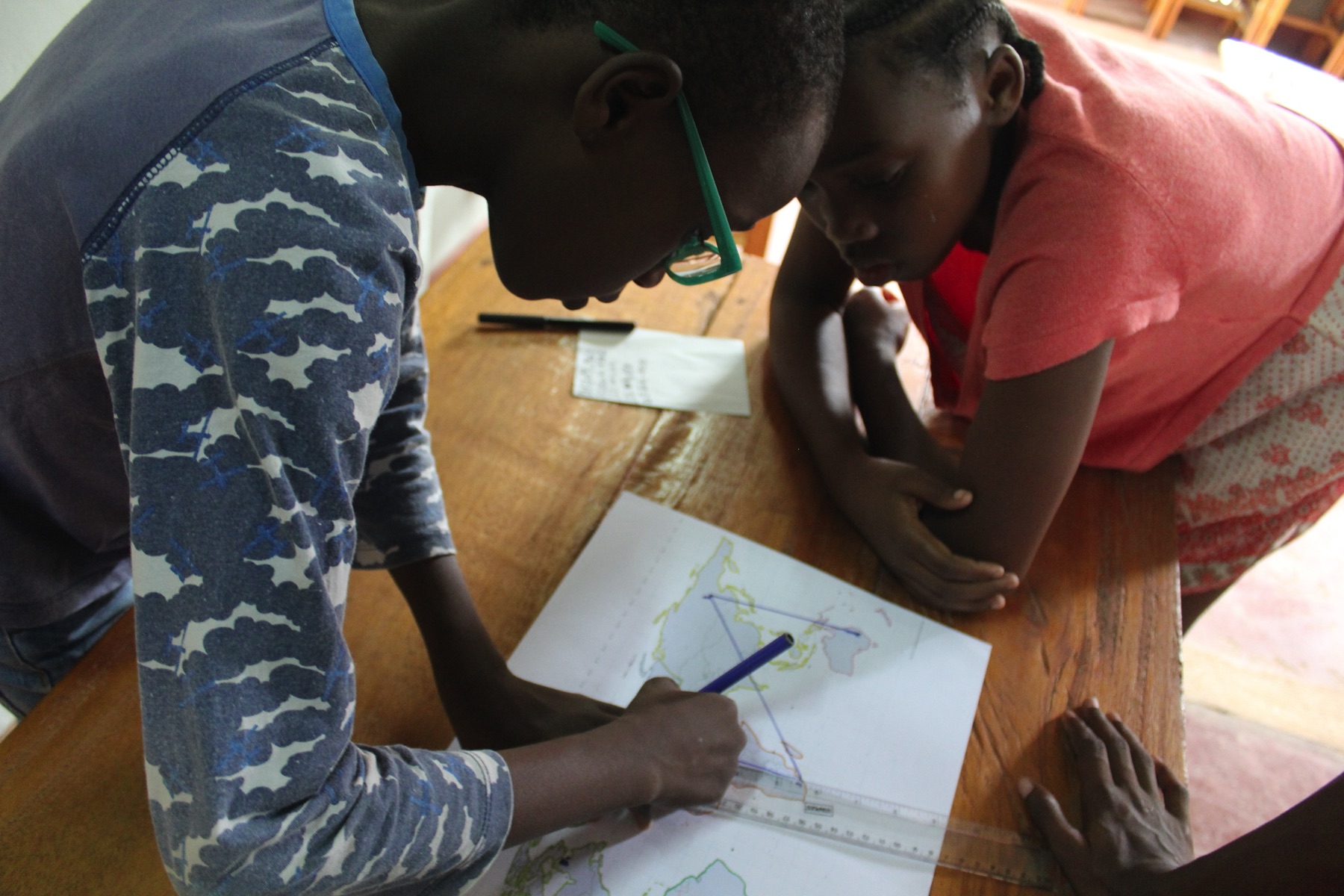
Our coordinates experts had no problem going from the Cartesian X and Y to the geographical Latitude and Longitude. If at first they were plotting points on a graph, in no time they were finding locations on a map!
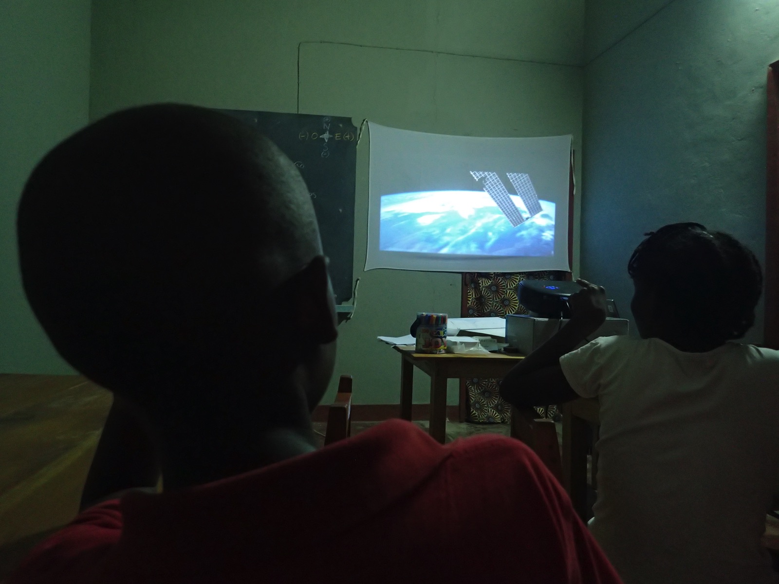
After that, it was time to talk a little bit about satellites. What do they do? And, how do they get up there? We showed them images of a space rocket – to get them acquainted with the ‘how’ – and then told them about some of the different missions that satellites have. Communications, weather monitoring, military, space observation, etc. Although, the ones we really wanted to focus on were the navigation satellites…
Specifically, GPS! ‘Global Positioning System’, for which GPS is the acronym. And, how does it work? Well, GPS is a network of about 30 satellites that are constantly orbiting the earth, and which you can, at any time, ask about your location.
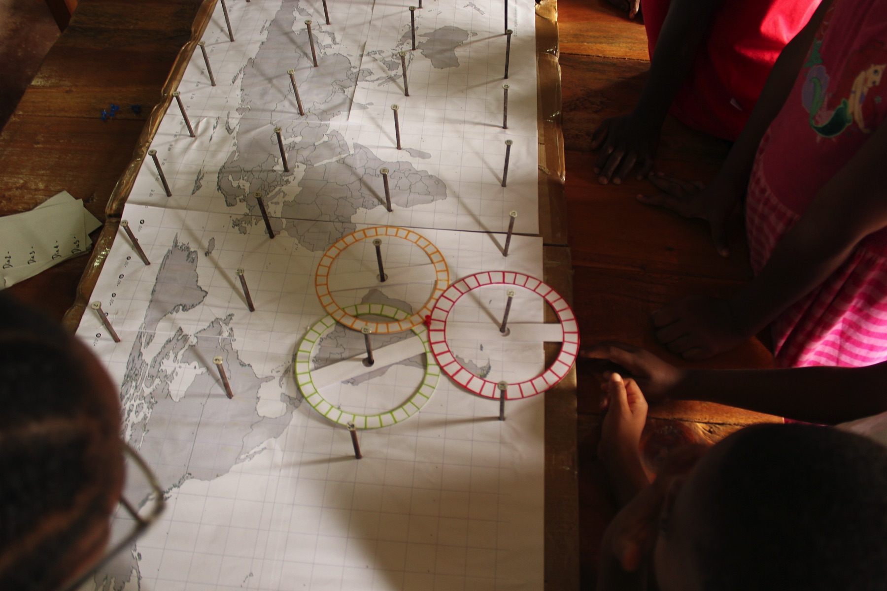
But, what do you ask them? Each satellite can only tell you one thing: how far away you are from it. This is done by calculating the time that it takes for your signal to travel to and from the satellite that you are consulting. If you know where the satellite is, and exactly how far you are from it, then you can trace a circle around the satellite. Now, you know for sure that you are somewhere along that circle.
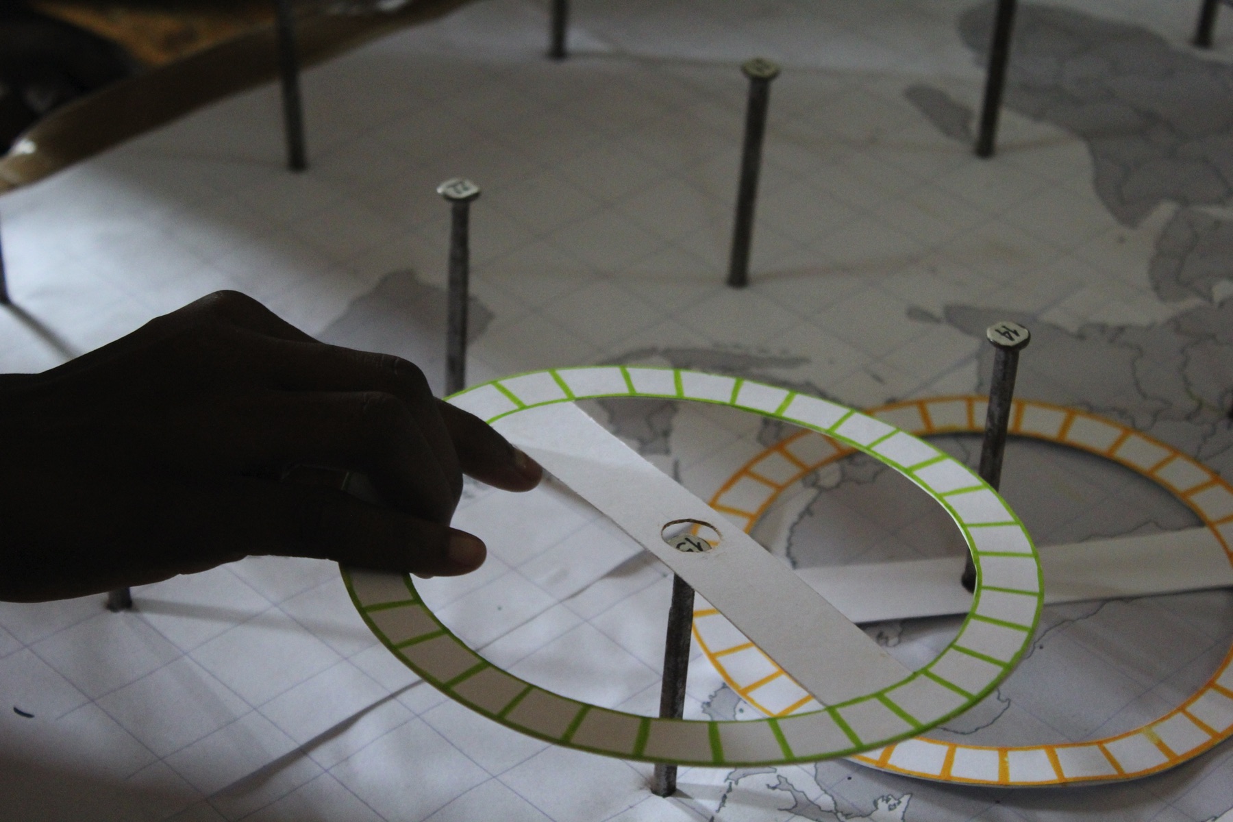
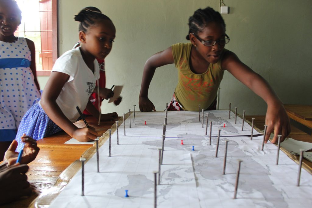
Which really doesn’t tell you much, does it?! That’s why you need to use trilateration. With one satellite you get a circle on a map and you can be anywhere around that circle. But, what if you ask the same thing of another satellite? If you ask two satellites, now you’ll have two circles that are overlapping. The problem is that they are overlapping in two places! You’re getting closer to finding out where you are, but you are still not sure. So, you ask a third satellite. And now, all three satellites overlap in just one place… Hooray! You found out where you are.
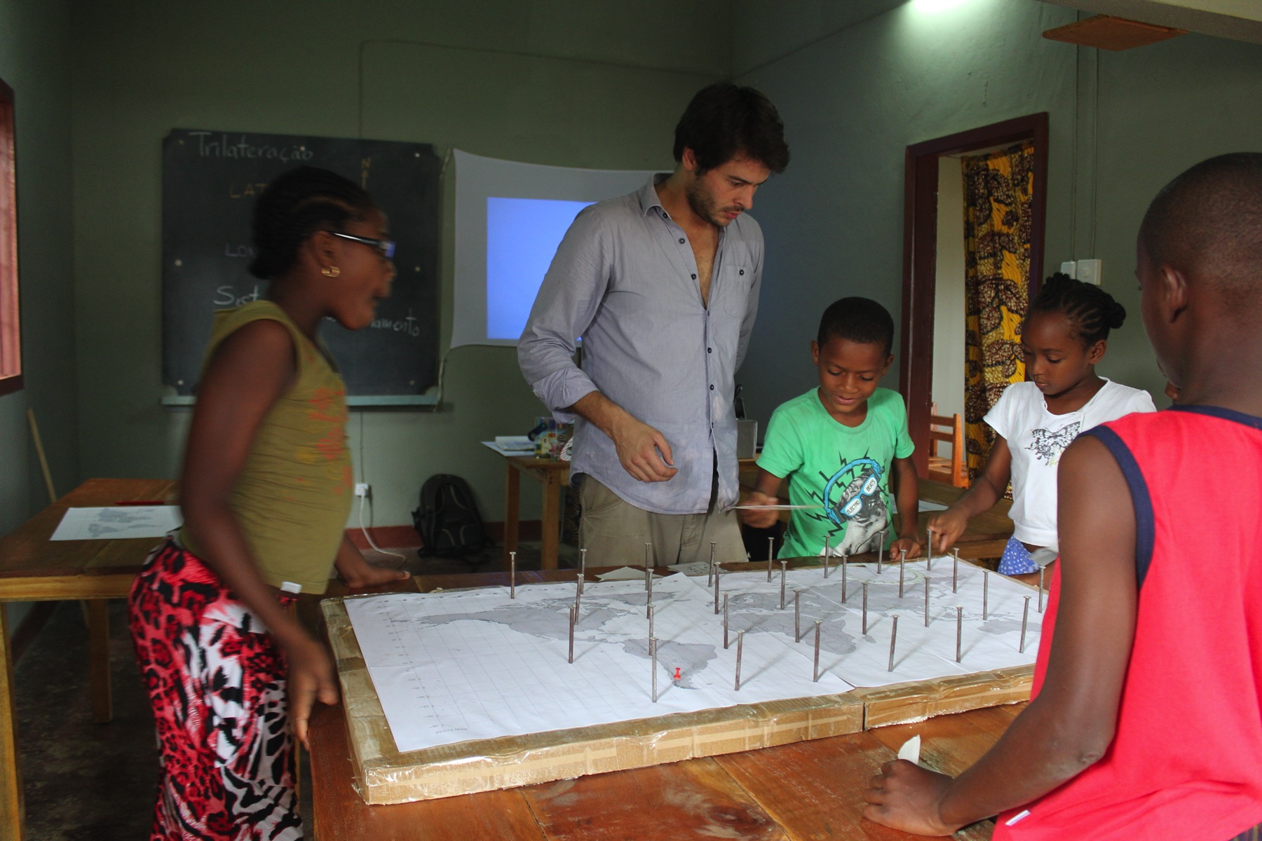
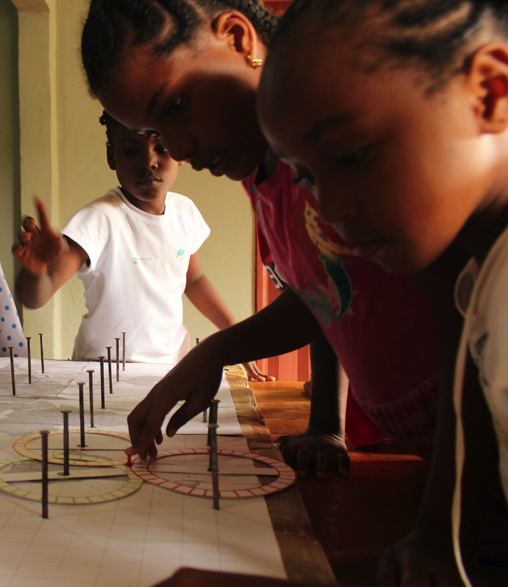
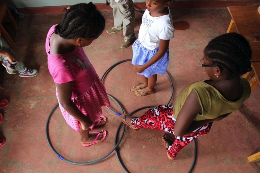
In order for our kids to understand this, we first used hula-hoops, just to give them the gist of the trilateration process. Then, we advanced to our ‘Trilateration Board Game’. Here you have 30 satellites (numbered nails) on top of a world map. Once you get signals from three satellites, you juxtapose the three circles, and, wherever they overlap, you then place your location pin and write down the geographic coordinates.
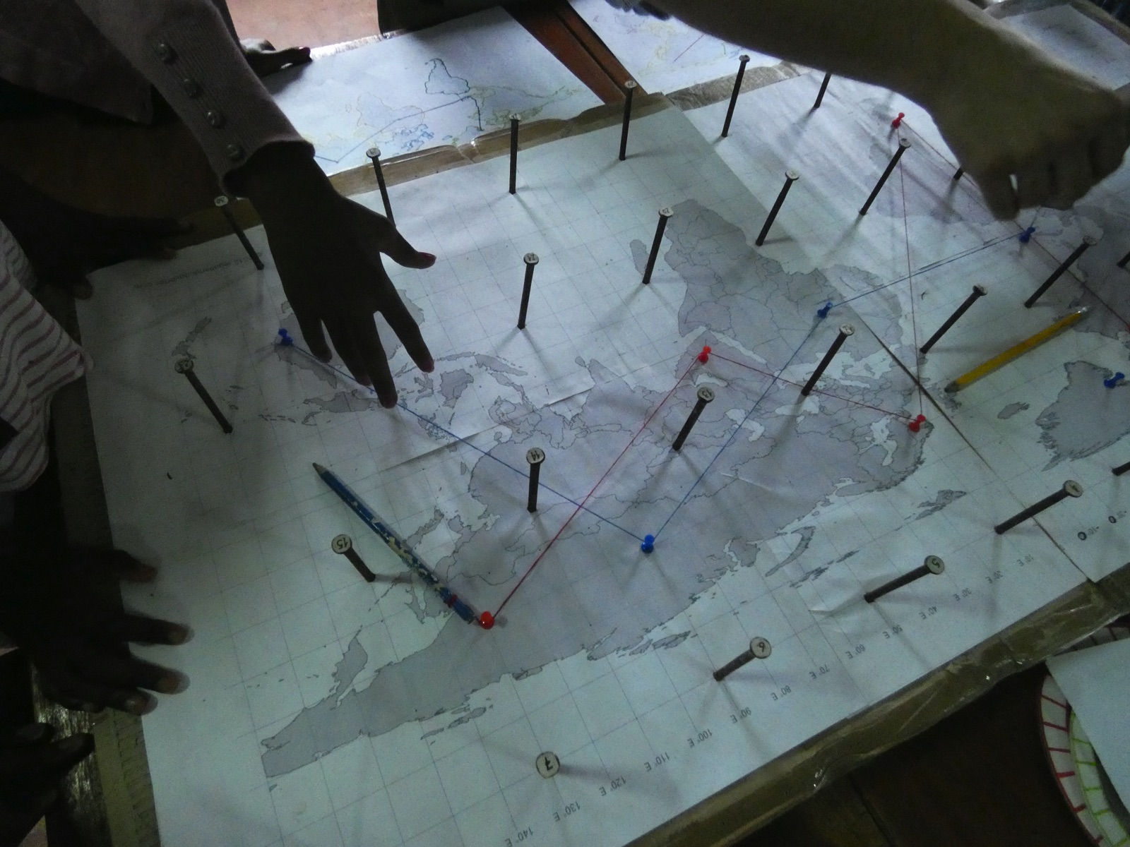
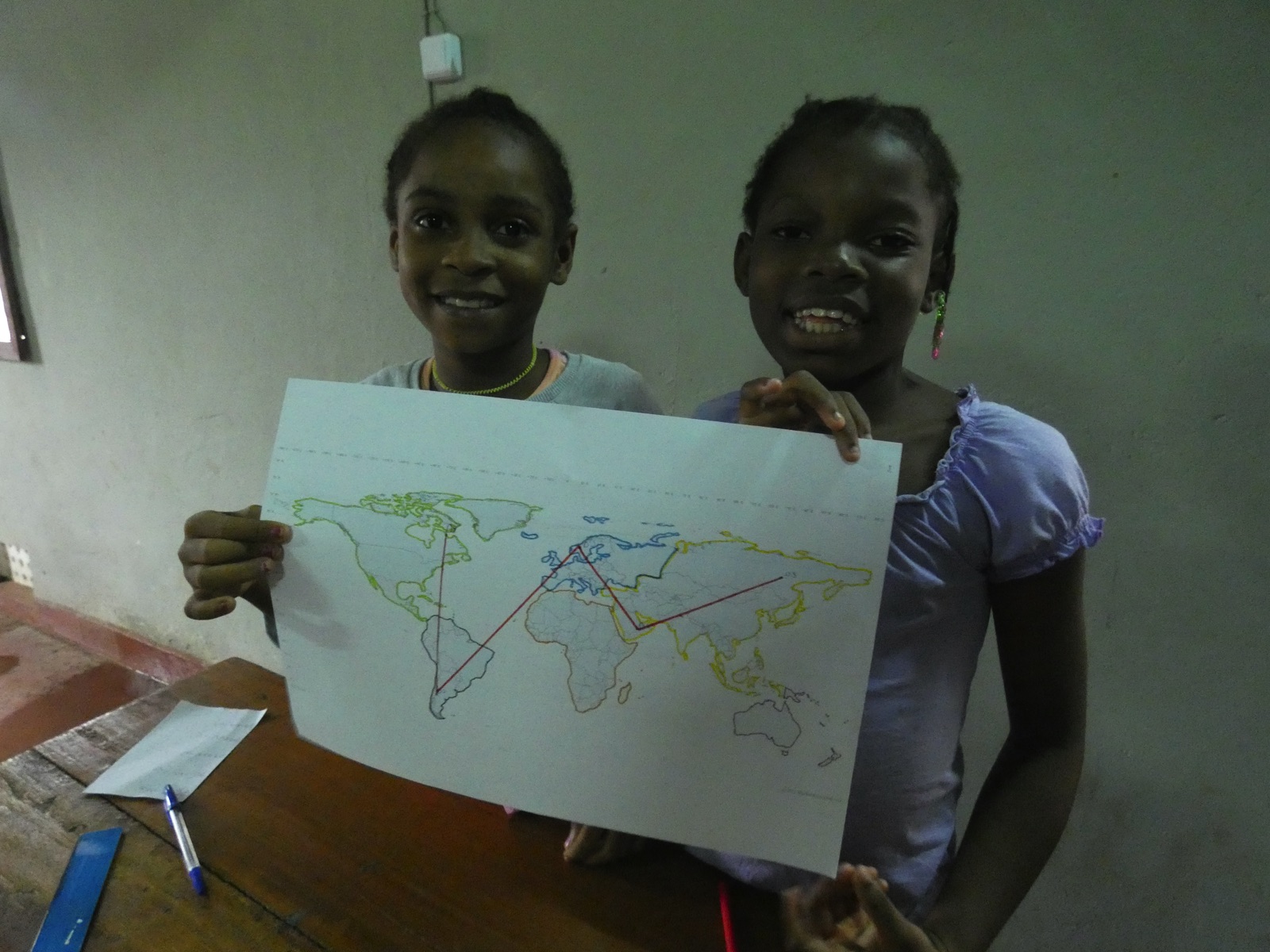
And that’s how we followed the journeys of ‘Ms. Red’ and ‘Mr. Blue’, finding out where these adventurous travelers had been going to recently. In the end we used some string and plotted their way across the map. It was also a great way to revise oceans and continents, as well as countries!